NYC Parks is seeking public input as it studies access and the climate resiliency of Pelham Bay Park, with a focus on eight areas identified as vulnerable to flooding.
The study, conducted in partnership with landscape architecture firm Starr Whitehouse, will help guide future capital improvements to the park, including upgrades to roadways, greenways and bus stop infrastructure, as well as measures to strengthen climate resiliency and improve the visitor experience.
The study grew out of a previous capital planning study focused on Shore Road. Instead of limiting its recommendations to that roadway, NYC Parks said they wanted to take a holistic approach to roadways throughout the park and identify priorities for future capital funding.
City Island Rising, a community organization that has promoted the study in recent months, has urged residents to participate in the process before surveys close at the end of the year, arguing that improvements to the park would not only improve access and flooding in the park — which connects City Island to the Bronx mainland — but benefit communities across the Bronx.
“City Island’s only 4,500 people in a city has nearly 9 million people, but the park is used by everyone in the city, and it’s used by a lot of people in the Bronx,” said City Island Rising board member John Doyle.
“The more that can be done to get people to participate in this study, will kind of send a signal to the power brokers down at City Hall that this is a priority not just for City Island but for the Bronx at large,” Doyle said.
At a Sept. 29 City Island Rising meeting, NYC Parks officials outlined how coastal storm surges could affect large areas of the park, while chronic tidal flooding currently affects smaller stretches of shoreline.
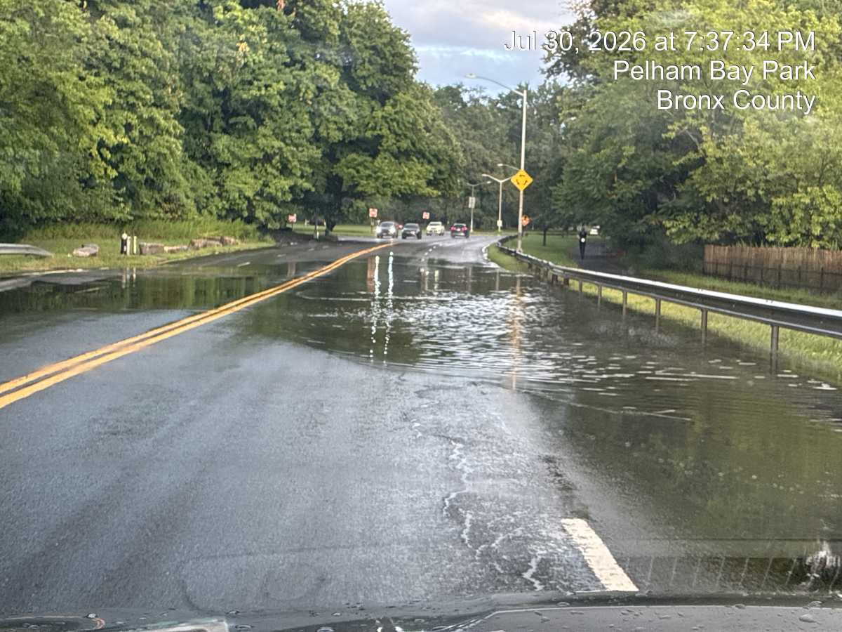
The eight flood areas of concern are: Pelham Parkway, Hutchinson River Parkway, Shore Road, Orchard Beach Road, City Island Road, the City Island Bridge, the golf course parking lot and Park Drive — including the Orchard Beach parking lot.
“We were able to see that high tide will also impact a lot of our key focus areas and destinations. So, storm surge tides, and then the day-to-day flooding that we’re seeing already from storms just like the ones that we experienced this weekend,” said NYC Parks planner Laura Melendez at the meeting, referring to the damage from the late September Nor’easter.
“We’re really trying to think of recommendations that will kind of solve a lot of these ponding and flooding issues,” Melendez said.
Beyond resiliency, NYC Parks is also taking a look at road, greenway conditions and public transportation access throughout the park. The agency has already found cracks, potholes, uneven pavement and faded road striping that can make navigation difficult for drivers, bicyclists and pedestrians.
Constant flooding also disrupts road access to City Island, which can affect emergency vehicles reaching the island when the few access points become impassable.
“This can lead to many accidents, and so getting this addressed is a real high priority for everyone. I think it’s probably one of those few issues that unifies everyone on the island,” Doyle said.
The study is also examining public transportation access. Seven bus routes serve the park, with 22 bus stops, including the Bx12, which extends service to Orchard Beach during the summer, as well as the Bx29, BxM8, Bx5, Bx23, Bx24 and Westchester Bee-Line B-L45.
NYC Parks is coordinating with the MTA to assess the bus stops and identify ways to improve safety and accessibility. The work will also inform a future proposal to renovate the closed Orchard Beach bus terminal.
Residents can learn more about the study and submit feedback through the Pelham Bay Park Access Study at this link.
Reach Marina Samuel at msamuel@schnepsmedia.com. For more coverage, subscribe to our newsletter and follow us on Twitter, Facebook and Instagram!