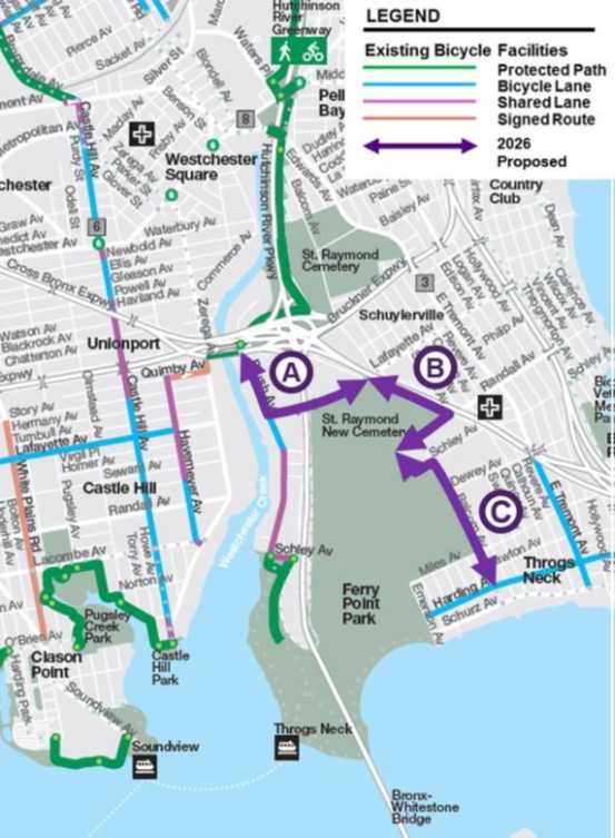
The New York City Department of Transportation is proposing a new bicycle network through Throggs Neck that would add protected bike lanes, change traffic patterns on several neighborhood streets and repurpose an estimated 70 parking spaces.
DOT presented the proposal to Bronx Community Board 10’s Municipal Services Committee on Sept. 9. The approximately two mile network is intended to create new connections to Ferry Point Park, the Throggs Neck Ferry Landing and the Hutchinson River Greenway, while improving safety for cyclists and pedestrians.
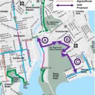
The proposed network would run along portions of Brush, Lafayette, Randall, Buttrick, Schley and Balcom avenues, as well as the Cross Bronx Expressway service road.
Some of the largest changes would take place along Lafayette Avenue and the Cross Bronx service road.
On Lafayette Avenue between Brush Avenue and the Hutchinson River Parkway, DOT is proposing a two way parking protected bike path along the north curb.
The plan would maintain the existing school loading zone, create dedicated pedestrian space for school pickup and dropoff and add an ADA compliant bus island at the Hutchinson River Parkway. DOT estimates the changes would result in a loss of approximately 24 parking spaces.
Along the Cross Bronx Expressway service road between Lafayette and Randall avenues, DOT proposes a two way protected bike path along the west curb and one travel lane west of the expressway off ramp. Approximately 45 parking spaces would be repurposed, which DOT said would also discourage illegal overnight truck parking.
Joseph Mondello, chairman of Community Board 10’s Municipal Services Committee, said residents often have concerns about how DOT projects could affect parking, local businesses, deliveries and everyday activities. However, he said he sees several benefits in this particular proposal.
Mondello said one of the biggest issues he continues to hear about is the unsafe operation of e-bikes and e-scooters, particularly riders using sidewalks or traveling outside designated bike lanes, creating dangerous conditions for pedestrians and motorists.
For Mondello, expanding the network could provide riders with a safer and more clearly defined place to travel while creating a better connection between neighborhood streets, Ferry Point Park and the Throggs Neck Ferry.
“As a growing number of New Yorkers are using two wheels as a primary mode of transportation, the need to expand bike routes is necessary,” Mondello said.
He said the success of the project will depend in part on whether riders actually use the infrastructure being provided.
“Ideally, I hope these lanes are used by bike riders so they have a dedicated place to ride instead of riding on sidewalks, and that riders adhere to the traffic laws,” Mondello said.
Mondello also welcomed the portion of the proposal aimed at discouraging illegal commercial truck parking along the Cross Bronx service road. DOT proposes repurposing approximately 45 parking spaces there, in part to discourage illegal overnight truck parking, an issue that has long affected the area.
The proposal has also received support from advocates who say the project would address gaps between existing bicycle routes in the East Bronx.
Kevin Daloia, an East Bronx pedestrian and bicycle safety advocate who also organizes ghost bike memorials throughout the city, has advocated for street safety improvements in the area for years.
Daloia pointed to earlier changes along East Tremont and Harding avenues and said the Throggs Neck proposal represents another step toward connecting routes that currently leave cyclists without a continuous network.
“We are always looking to connect the current broken bike corridors, and the Throggs Neck Bike Network will do that,” Daloia said. “The path along the Cross Bronx Service Road will eliminate the tractor trailer parking along the cemetery.”
Daloia, who said he rides to the Throggs Neck Ferry several times a week, said the proposed network would create a new and safer way to reach the ferry while improving connections to the Hutchinson River Greenway.
“I have had a print of the original plan on the wall in my office for four years and I am very pleased that NYC DOT listened and made some changes that make it better, longer and safer to ride near the waterfront,” Daloia said.
Other changes proposed by DOT include a two way parking protected bike path along Randall Avenue. Converting parallel parking to angled parking between Balcom and Buttrick avenues is expected to create approximately 10 additional parking spaces.
Portions of Buttrick and Schley avenues would also be converted to one way streets to accommodate protected bike paths. DOT cited low traffic volumes and relatively few destinations along those streets in proposing the conversions. The Schley Avenue portion would connect the network directly to an entrance to Ferry Point Park at Balcom Avenue.
The project would continue along Balcom Avenue toward Harding Avenue using a combination of protected infrastructure, shared lanes and traffic calming measures. DOT is also proposing shorter pedestrian crossings, a mini roundabout at Miles Avenue and signal studies at Randall and Balcom avenues and Randall and Dewey avenues.
DOT said the proposal comes amid increased bicycle and e scooter use in the East Bronx. The agency reported 700,000 e-scooter trip starts in East Bronx neighborhoods in 2024 and approximately 6,700 trip starts along Throggs Neck corridors during the first three months of 2025. DOT also reported no fatalities associated with those trips and a rate of one crash for every 8,075 trips.
The project is expected to move forward in phases. DOT’s presentation lists Brush, Lafayette, the Cross Bronx service road, Randall, Buttrick and Schley avenues for the first phase in fall 2026. The Balcom Avenue portion between Schley and Harding avenues is listed for a second phase in spring 2027.
The plans remain subject to final design and engineering review.